
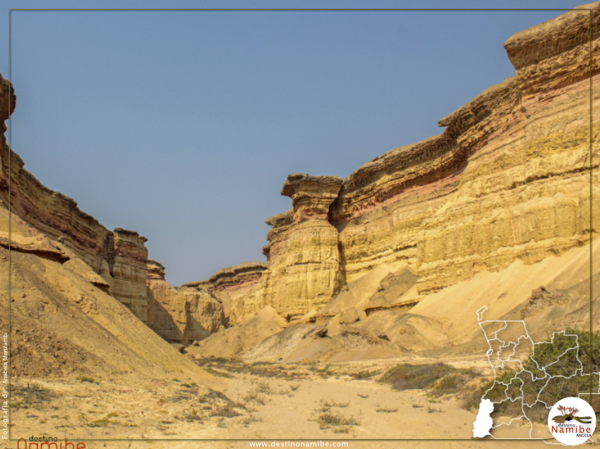
Eight large rivers flow westwards to the Atlantic Coast from their catchments along and in the escarpment that separates the coastal plain from the interior plateau (see page 54). From north to south they are the Catára, Carunjamba, Inamangando, Bentiaba, Piambo, Giraúl, Bero and Curoca. The catchments of the four southern rivers – the Bentiaba, Giraúl, Bero and Curoca – are comparatively large, covering broader inland areas than the narrow catchments of the Carunjamba and Inamangando Rivers. The Catára and Piambo Rivers have small catchments. South West Angola’s west flowing rivers are an anomaly, or seemingly so. On the one hand they rarely have water, let alone flows strong enough to reach the sea. Yet the rivers are generally broad, often deep and clearly defined as they cut down through the arid coastal plains. Consider how the Rio Carvalhão (above) has sculpted its course just inland of Tômbua, where an average of less than 50 millimetres of rain falls each year. At least two processes explain this paradox.
 First, the rivers have ancient histories going back tens of millions of years. Over those long periods the climate has often changed, sometimes into much wetter periods with rainfall two, three and more times greater than now. The rivers then carried substantial volumes of water which would have shaped the wide and deep valleys we see today. Second, there are occasional floods down the rivers nowadays, brought on by exceptional falls of rain in their catchments. While the flows can last weeks, it is the short-lived, raging torrents of floodwater that do the work of erosion. The wild waters carve away embankments, gouge out new channels and uproot trees, but also bring water with fertile silts that settle on wide floodplains. Such floods happen every few years, but then imagine the thousands of floods that have cumulatively occurred over a period of 50,000 years, or more. That makes it easier to see why such magnificent river valleys adorn this arid environment.
 English
 Português